
- Worksheets>
- Social Studies>
- United States Maps
Blank Maps of USA Worksheets
Learning about your country's political division into fifty states, their boundaries and their capital cities is an essential expansion of your knowledge base. We take this privilege of extending all this learning for students of grade 2 through grade 5, with our set of printable blank maps and pdf worksheets on the United States of America, using creative tools like printable labeled and unlabeled maps, flashcards, word grids, puzzles, and many more 'learning by doing' activities. Free U.S. maps worksheets are also up for grabs.

Use this printer-friendly unlabeled blank map of the United States to serve the purposes of; revising practices, preparing for a test or for some interesting coloring tasks.
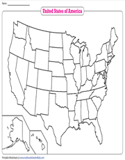
Political Blank Map of the U.S.
Our printable political blank map of the U.S. with the states outlined will help children of elementary school, identify the location and boundaries of the fifty states. It can be used for multiple exercises and practice.
50 States of USA
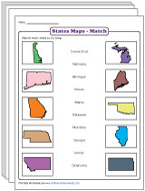
Augment knowledge on the fifty states and their capitals with our PDF worksheets containing labeled maps, flashcards, identifying and labeling activities on blank maps, reading comprehension passage and writing prompts.
(18 Worksheets)
U.S. Regions Map

Use this printable map showing the regions of West, Midwest, Northeast, Southeast and Southwest of our country to comprehend and identify how our fifty states are grouped together.

No effective teaching methodology for young learners can ever be devoid of some coloring activity, Can it? So let's bring in the fun of coloring the regions on the blank map of USA for enhanced learning.
Latitude and Longitude of United States

Understand measuring and locating the accurate horizontal and vertical extent of USA and its states, using degrees of longitude and latitude with this printable map.
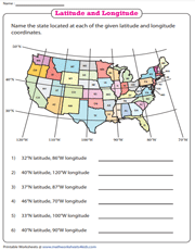
Latitude and Longitude of United States
Knowledge of latitudes and longitudes of the Earth is valuable in understanding precise locations, time, weather and more. Give grade 3 and grade 4 kids some practice in interpreting these coordinates, with this map worksheet.
Map of Colonial America
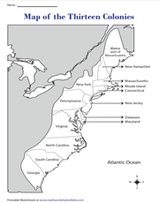
Connecting with our past provides meaning to our present. Hence, involving 2nd grade and 3rd grade children in this pdf worksheet of the map of colonial America, will help deepen their understanding of today's America.
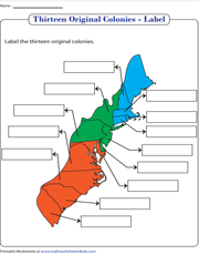
Locate and Label the Colonial America
Children will look back to the glorious past with pride, with this exercise of locating and labeling the thirteen colonies of the U.S. on a blank map and will look forward to knowing some more!
Physical Map of USA
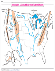
River, Lakes and Mountains of USA
This physical map of the United States illustrates the location of the geographical features like the major mountains, rivers and lakes, enabling students to identify and locate them.
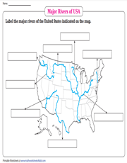
Use this map printable to help students identify, locate and label the major rivers of the country. See the length and breadth of the Missouri, Mississippi and many other rivers on the map.
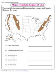
Learn to locate and label the major mountain ranges like the Appalachian, the Rocky, the Sierra Nevada and many other ranges, using our map worksheet for 4th grade and 5th grade. Kids' excitement is sure to soar high.
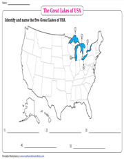
Find out and label the five Great Lakes of the U.S. It will be interesting to see how four out of the five greatest lakes lie along the border between America and Canada.